
Follow a Topeka Street Trail
A Topeka street directory search works best as a chain. First, prove that the city locator recognizes the address. Then identify the Shawnee County parcel and its current assessment owner. A deed reference can lead to recorded title parties, while the election office and historical shelves can supply narrower evidence about a named person at that address. Each step answers a different question.
- Normalize the address in the Topeka composite geocoder. Keep NE, NW, SE, or SW, the street type, unit, ZIP, and ZIP extension.
- Search Shawnee County ARES by Address, then open Map Search. Save the QuickRef, PID or PIN, situs address, owner display, and legal description.
- Read the deed clue and search the Register of Deeds access choices by grantor, grantee, book and page, date, or document type.
- For a named voter, ask Shawnee County Elections about its controlled by-street counter books or retained poll books. Do not treat voter data as an open block roster.
- For an earlier household, consult the Topeka Room city directories and later cross-reference books, preserving the printed street name and year.
The flow is address → parcel → owner display → deed index → date-specific resident evidence. A missed match is a reason to check format and date, not proof that the address or person never existed.
Shape a Topeka Address
The city geocoder accepts both a single-line entry and separate Address, City, Region, Postal, and PostalExt fields. Its wider interface also supports neighborhood, search extent, match controls, and output fields. It is useful for spelling and location checks before the same text is tried in a county system. The service is public, and the research found no account or payment gate.
Directional prefixes are part of the key. “200 SE 7th” is also the form used in an ARES example. Keep apartment or suite data even when the parcel roll resolves only to the main tract. A parcel may cover more than one site address, and a corner tract may face a second street. Write down the exact form each custodian returns.
- Parcel
- A mapped tract with its own county identifier and legal description.
- Situs address
- The physical site label, which can differ from the address used for tax mail.
- Plat
- A recorded drawing that divides land into lots, blocks, streets, or easements.
- Criss-cross directory
- A later directory arranged by street and number, letting an address lead to a listed name.
Search Topeka Streets in ARES
ARES is the fullest current property route for the Topeka street directory. It is terms-gated and requires the Kansas Open Records Act certification about prohibited commercial use of names-and-addresses lists. Its basic search had no observed fee. The portal displayed an update date of August 23, 2026, but warns that valuation and tax fields may refresh at different times.
| ARES control | Type | Required | How it works |
|---|---|---|---|
| Search Criteria | Text | Yes | Accepts an owner, address, QuickRef, parcel ID, or subdivision term. |
| Search By Field | Dropdown | No | Unfiltered Search, Address, QuickRef, Owner Name, Parcel ID, or Subdivision. |
| Search | Button | Action | Runs the chosen query. |
| Map Search | Link | No | Moves from the record search to the parcel map. |
| KORA certification | Acceptance | Yes | Confirms the restriction under K.S.A. 45-220(c)(2). |
ARES returns a property card, not a household list. Use it to pin down a parcel, assessment owner, value, legal text, and map link. If the goal becomes one named person, the focused Topeka resident lookup keeps that task clear.
Map Topeka Parcels by Street
The Shawnee County parcel layer supports query, identify, find, export, distance, and geometry operations. Its fields include ONAME, PADDRESS, MAILNAME, MAILADDRESS, DBOOKPAGE, subdivision, legal description, neighborhood, tax unit, values, and several parcel IDs. A sound by-street method starts at a known junction, clicks each polygon in order, and records its own QuickRef or PID. Do not merge two lots because an owner label or street number looks alike.
The county parcel service shows why a map works well for corner lots, alleys, utility tracts, and parcels with several addresses.
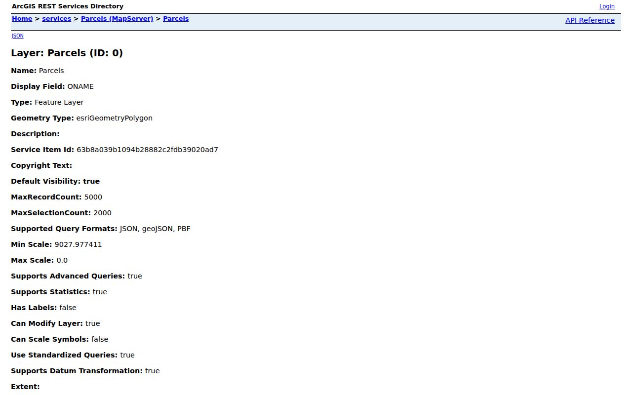
Those fields let the same Topeka parcel be carried into the assessor and deed search without guessing from a name.
Two Topeka Address Fields
A key Topeka quirk is the split between PADDRESS and MAILADDRESS. The first is the parcel’s physical site. The second is where tax correspondence goes. It may belong to a company, trust, bank, or owner outside the city, and it can include a different ZIP extension. ONAME and MAILNAME can also differ. None of those fields identifies everyone present at the site.
DBOOKPAGE and the legal description add continuity when a street label changes. A modern address is a useful locator, but the parcel polygon and legal land text are stronger links across time. This distinction prevents a common street directory error: calling a tax mailing destination the residence.
Note: Record the query date because owner, valuation, tax, and map fields may not update on the same day.
Topeka Records Indexed by Address
A full street-by-street check uses records held by different custodians. The parcel key joins many of them, but each set has its own channel and meaning. Older deeds can be searched at the Register counter when a web image is unavailable. Permit history can require Planning staff when it falls outside the current layer.
| Address record | Local keeper | Street evidence | Access route |
|---|---|---|---|
| Assessment parcel | Shawnee County Appraiser | Owner, situs, mailing, QuickRef, value, legal text | Free ARES search and parcel map |
| Land documents | Register of Deeds | Grantor, grantee, transfer, mortgage, plat, easement | Free office terminal; Tapestry or Laredo |
| Residential permits | Topeka Planning | Case name, location, status, type, and dates | Public ArcGIS view; written request |
| Election material | Shawnee County Elections | Controlled name and address evidence | Counter books, inspection, poll books |
| Historic directories | TSCPL, KSHS, TGS | Printed name, address, role, reverse listing | Shelf, catalog, archive, summary index |
The County Clerk real-estate page points to a public computer, GIS, ownership maps, road maps, and homestead information.
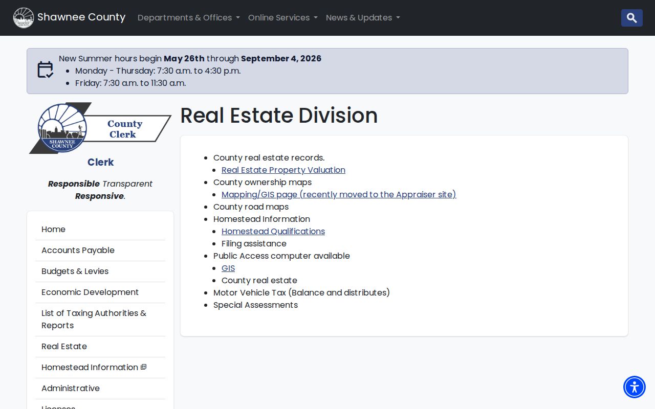
At the courthouse, Room 107 is the Clerk’s route, Room 108 is the Register’s deed counter, and Room 101 handles Treasurer tax records.
Deeds Along a Topeka Street
Shawnee County describes its recorded real-estate series as 1856 to the present. Free in-house computers allow searching with staff help, and the option page lists copies at fifty cents per page or free delivery by email. Tapestry reaches back to 1856 and is listed at $8.95 per search. Laredo Anywhere supplies subscription access at published minute tiers. These are alternate doors to the official index, not identical products.
Begin with the parcel owner and DBOOKPAGE clue. In the deed index, identify the grantee on that transfer, note the grantor and prior book/page reference, and repeat backward. Names reveal title parties, not occupants. Plats and legal descriptions hold the trail to the right lot when a Topeka street name differs.
An early gap may be bridged by TGS Columbian Title abstract volumes or KSHS and FamilySearch microfilm. The Register can explain its index but will not conduct an ownership or lien search for the requester.
Date Topeka Sites With Permits
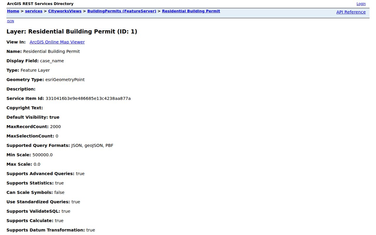
The Cityworks residential layer adds case_number, case_name, location, case_status, case_type, case_type_desc, date_entered, date_issued, date_expiration, and daysSinceIssued. A case name may be an applicant, contractor, or owner, so label it exactly. A complaint is not proof that a violation was upheld.
The Topeka residential permit layer is shown below.
For older work, the Topeka Building Permits index covers 1880 through 1925. Planning accepts written requests keyed to an address or parcel ID and says staff will contact the requester within three business days with cost. The public layer states no historic start date.
Topeka Streets Changed in 1937
A real address can vanish from a cross-year search because Topeka street-name changes were made in 1937. The Topeka Genealogical Society’s “New Street Names in Topeka” guide is the verified bridge. No full number or annexation history was confirmed, so match the old spelling, quadrant, cross streets, legal description, subdivision, and a historic map footprint.
Keep the old label in the notes. Then test nearby numbers in the same volume. A cluster of neighbors that reappears under a new name can support the match, while one same-name person cannot. The Topeka city directory collections explain how Radges, Polk, telephone, and cross-reference runs differ.
Topeka Street Election Records
Shawnee County Elections describes free alphabetical and by-street counter books, weekly statistics, public inspection, and poll books retained for four years. Poll books can contain voter name, address, age, and election information. Public inspection copies are listed at fifty cents per page. Advance-voter inspection has appointment, identification, and logbook rules, and advance lists carry a stated minimum and per-page cost.
These are controlled office records under Kansas election rules, not a downloadable street directory. VoterView is for an individual registration check. Ask for the period and record type, follow office procedure, and never turn a permitted inspection into an unrestricted roster.
Limits of Topeka Street Records
A parcel owner may live elsewhere. A permit name may identify a contractor. A directory entry may have been gathered months before print, and a voter record speaks only to registration for its period. Utility customers, every person in a unit, and a live occupant roster were not exposed by the official sources. Safe at Home substitute-address rules can also prevent a true address from appearing.
Apartment buildings add another gap. A county parcel can cover the full tract while a permit uses one main address and a printed directory lists only selected units. Preserve a unit number when the source gives one, but never assign a person to that unit from the assessment owner field alone.
Use records lawfully. Keep Topeka address work to personal, civic, property, or family research. Never use street records to stalk, harass, threaten, or expose a protected person.
The best result states what each record proves, its date, and its limits. That makes a Topeka street directory useful without turning a public field into a claim about a private household.